Who is a member?
Our members are the local governments of Massachusetts and their elected and appointed leadership.
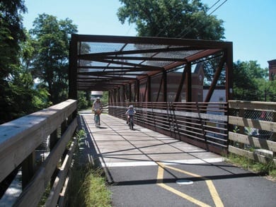 Northampton is using an online tool that allows the public to draw the routes they usually bike or walk in the city as well as routes they would like to see improved.
In conjunction with in-person forums and meetings, the tool is helping the city cast a wide net for public input as it develops a comprehensive walking and biking plan that will guide planning efforts.
The online map is created through Wikimapping.com, which has a flat annual fee of $349. The “crowdsourcing” effort is one part of a larger outreach, according to Wayne Feiden, Northampton’s director of planning and sustainability.
“Public process is great, but we know the people who show up at public meetings,” Feiden said. With the online tool, he said, “we get a different kind of comment than from the people at public meetings.”
Using $50,000 in grant money – half from the Partners for Place initiative of the Funder’s Network for Smart Growth and Livable Communities, half from the Community Foundation of Western Massachusetts – Northampton partnered with the Pioneer Valley Planning Commission, which is heading up the public engagement process for the comprehensive walking and biking plan.
Dillon Sussman, senior planner at the planning commission, said the online crowdsourced map is a first for the commission, inspired by what Cambridge did when it developed its own bike plan as well as Boston’s “Vision Zero” online map tool.
“Boston’s is kind of interesting because it’s an ongoing map, to basically inform ongoing planning instead of a one-off plan,” Sussman said. “My hope is that Northampton could do something similar, using an online mapping platform to gather input about conditions that change over time.”
The commission is also undertaking broad, in-person outreach measures, in particular trying to engage typically underserved populations, Sussman said, by making translation services available at public forums about the plan, providing childcare at meetings so young parents can attend, and holding drop-in meetings – like office hours – at each public housing complex in the city.
Paper maps are brought to the public forums and drop-in meetings, along with a laptop that allows people to use the wikimap if they wish. Surveys skew toward higher-income and more-educated demographics, Sussman said, and adding technology can compound the problem.
“The idea was to bring the wikimap to those drop-in meetings and help people through the process of using it,” he said. “So far, people actually would much rather just talk to us and have us mark up what they’re saying on the map. … But the wikimap is still useful in that we can take all the comments on the paper map and enter them into the wikimap.”